Friday, March 4, 2011

My hosting Accretionary Wedge #32 - favorite geological pictures.

 This was formerly over at Ann's Musing on Geology and other things.  That blog no longer exists so its been moved here.

WELCOME TO THE KREWE OF ACCRETIONARY WEDGE #32
It's carnival time in the south and since the Accretionary Wedge is suppose to be a carnival of blogs and information I feel it is only fitting that we should have a parade of favorite geologic pictures to post. I've posted them in the order in which they were received.
Thank you all for participating and making it such a wonderful parade.

@-@-@-@-@-@-@-@-@-@-@-@-@-@-@-@-@-@-@-@-@-@-@-@-@-@-@-@-@-@-@-@-@-@-@-@-@-@-@-@-@-@-@
We will start this parade with some parade music to get into the spirit while you look at the wonderful pictures.
Here's '76 Trombones Led the Big Parade' from the movie 'The Music Man'

@-@-@-@-@-@-@-@-@-@-@-@-@-@-@-@-@-@-@-@-@-@-@-@-@-@-@-@-@-@-@-@-@-@-@-@-@-@-@-@-@-@-@

First of is Dana with the float from   En Tequila Es Verdad

Dana had a hard time picking on a favorite photo, so instead she picked a favorite geologic place to go to.  Can't you imaging yourself going there for some peace and quiet?  Isn't it a fantastic place to visit?

Here's a little of what she wrote:  ....... we'll do this.  We'll cut to the chase and play a favorite - a favorite place, one of my favorite places in the world.  We'll take a trek through the desert and come upon an oasis.
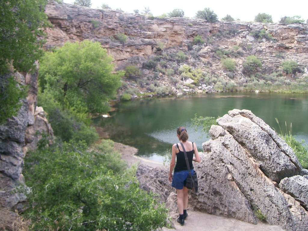

Montezuma Well, ambush shot by Cujo
Down around Camp Verde in Arizona, you'll come across a picture-perfect karst terrain.  The old beds of lake-deposited limestone lay flat, dry and hot under the sun, carved into gullies and hills by wetter times.  In some places, sinkholes pit the scenery.  They're lovely examples of the power of water and gravity together to sculpt the scenery.

Camp Verde got its name because a river runs through it, causing a line of green to conga through the hot, scrubby hills.  It was enough of a shock that explorers named it the Verde River, because it was very nearly the only green thing they'd seen for absolute miles.


You will have to go to her blog to read more about this delightful place.
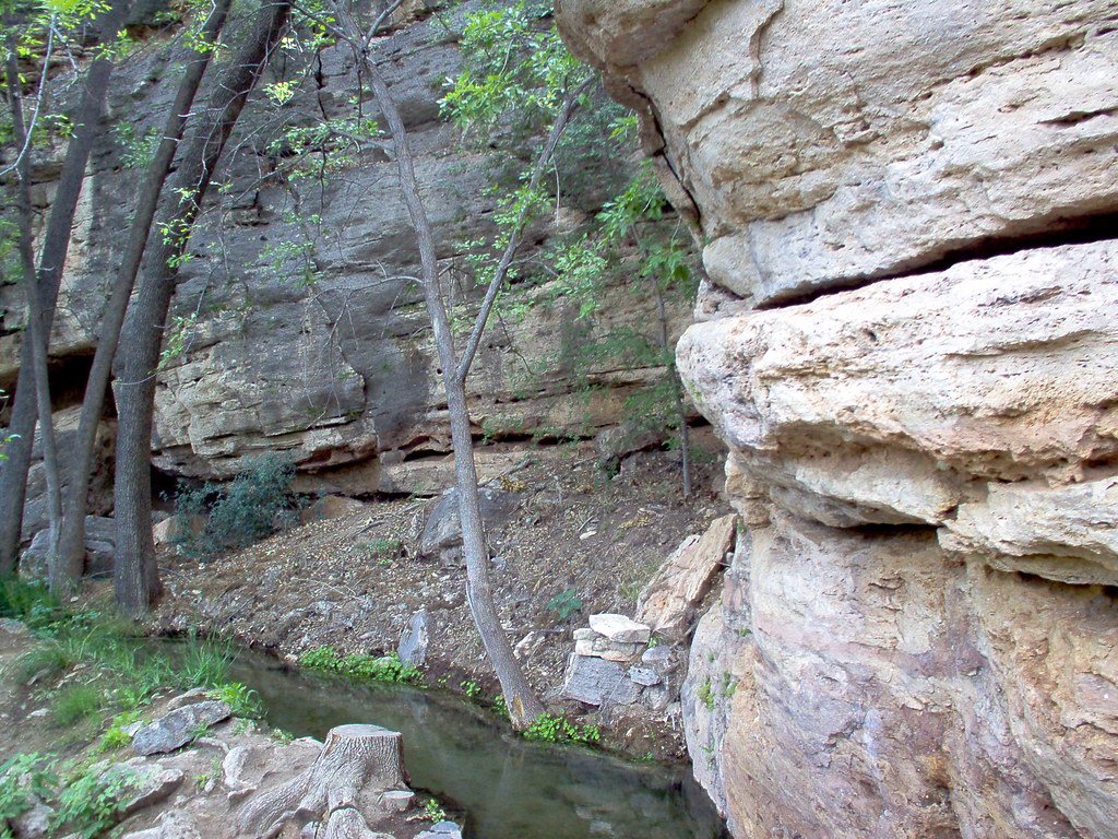
The old Sinagua canal

She ended with and I agree:
Now that you've had a nice rest at the water's edge, on with the parade! 

@-@-@-@-@-@-@-@-@-@-@-@-@-@-@-@-@-@-@-@-@-@-@-@-@-@-@-@-@-@-@-@-@-@-@-@-@-@-@-@-@-@-@

Jim has two pictured of the fascinating Gooseneck of the San Juan River for his float at


Well since I have done this for a previous AW, I will switch up the picture I used and this time give you a couple of glimpses into the Gooseneck of the San Juan River.


Gooseneck of the San Juan River 
@-@-@-@-@-@-@-@-@-@-@-@-@-@-@-@-@-@-@-@-@-@-@-@-@-@-@-@-@-@-@-@-@-@-@-@-@-@-@-@-@-@-@

Matt's float is here at Research at a Snails Pace    
with a breath taking view of the island of Maui, Hawaii.
(I'm having trouble with this link so here's it is
http://pascals-puppy.blogspot.com/2011/03/aw-32.html )

He writes:
So here's one of my favorite pictures - Haleakala crater. Technically, this isn't the actual crater, it's the eroded summit, widened by erosion. The smaller hills are cinder cones that erupted after most of the shield volcano was eroded away.

HaleakalaPano1

@-@-@-@-@-@-@-@-@-@-@-@-@-@-@-@-@-@-@-@-@-@-@-@-@-@-@-@-@-@-@-@-@-@-@-@-@-@-@-@-@-@-@

 Here's the float from Jessica at  Magma Cum Laude with this beautiful picture.  She writes:
One of my favorite geologic photos is plenty colorful – and it’s also from my first field course, a month-long tour of the Colorado Plateau. The contrast between the sand and sky at Coral Pink Sand Dunes State Park in Utah is truly striking, and it was one of my favorite stops on the trip – because it’s also an excellent place for a game of frisbee!


@-@-@-@-@-@-@-@-@-@-@-@-@-@-@-@-@-@-@-@-@-@-@-@-@-@-@-@-@-@-@-@-@-@-@-@-@-@-@-@-@-@-@

 From Evelyn we have a first time entry for the AW.  Welcome aboard Evelyn!!!  Here's her  float from Georneys

She writes:
One of my favorite geology pictures (I have several- so difficult to chose!) is a picture of my favorite campsite ever. The picture below shows a makeshift campsite just off a road in northern Oman. The beautiful mountain in the background is Jebel Misht, one of several exotic limestones in the middle of the Samail Ophiolite. I was lucky enough to spend a few nights at this campsite in 2009 and 2010 as part of my PhD thesis fieldwork. One of my field sites, located near the small village of Al-Bana and close to the Misht campsite, has been named "Jebel Misht Travertine" by my research group.


Jebel Misht is a popular climbing destination. Making your way up the tall southeast cliff is not an easy task.  When a French team of climbers accomplished the first successful ascent of Jebel Misht in 1979, the Sultan of Oman arranged to have the climbers picked up by helicopter from the top of the mountain and whisked off to the palace for a celebration. Jebel Misht means "Comb Mountain" in Arabic. Indeed, the mountain's majestic cliff resembles a gigantic comb resting peacefully amidst the seafloor rocks of the ophiolite.


I am glad she came up with something and has joined the parade!!

@-@-@-@-@-@-@-@-@-@-@-@-@-@-@-@-@-@-@-@-@-@-@-@-@-@-@-@-@-@-@-@-@-@-@-@-@-@-@-@-@-@-@


From the float at  Mountain Beltway  Callan has these interesting things to say:

He writes..... While it’s not my favorite, it’s definitely a favorite, more by virtue of the geology it shows than the aesthetic qualities of the image:
That is an outcrop of the French Thrust, one of many imbricate thrust faults exposed in Sun River Canyon, Montana, just west of Augusta. The light colored rock at right is limestone and dolostone of Mississippian age, and the dark rock at the lower left is shale of Cretaceous age (deposited in the Western Interior Seaway). Beyond that, to the very far left, you can see some lighter-colored, poorly-sorted material. That’s Pleistocene glacial till, and both the shale and the till are capped by a sloping layer of colluvium, tumbling down from higher elevations. The contact between the shale and the dolostone is a thrust fault. Half a mile downstream there is another. Half a mile upstream there is another. There are a lot of them exposed in Sun River Canyon, and the Canyon cuts across strike of all of them. Note the syncline in the Mississippian carbonates, and the differential weathering of the carbonate (tough, proud) as compared to the shale (weak, depressed). Here’s an annotated version of the photo:

The Sun River Canyon is an unparalleled location in my experience for gorgeous scenery, great weather, a minimum of people, a healthy population of great gray owls, and exceptional exposures of an imbricate stack of thrust sheets. Check out this old post I put up at Pathological Geomorphology for more details about the area.


@-@-@-@-@-@-@-@-@-@-@-@-@-@-@-@-@-@-@-@-@-@-@-@-@-@-@-@-@-@-@-@-@-@-@-@-@-@-@-@-@-@-@

Helena' float at   Liberty, Equality & Geology   has this wonderful  panorama for her float.


It’s always hard to pick a favorite geology picture, but this wintery Crater Lake panorama tops my list right now. Crater Lake is one of my favorite places, and it was exciting to visit in the winter! The perfect mirroring effect was particularly stunning. In person, the sky and water were the same color, making the caldera look like an arch in the sky.
Composite
 
@-@-@-@-@-@-@-@-@-@-@-@-@-@-@-@-@-@-@-@-@-@-@-@-@-@-@-@-@-@-@-@-@-@-@-@-@-@-@-@-@-@-@  


Julia has a very intriguing float from  Stages of Succession  .  You need to make sure you get a good look at what you are seeing.  Please go to her blog to figure out if you are right or not.


@-@-@-@-@-@-@-@-@-@-@-@-@-@-@-@-@-@-@-@-@-@-@-@-@-@-@-@-@-@-@-@-@-@-@-@-@-@-@-@-@-@-@


Gareth's float at  Science 2.0    is very interesting to see because it has a volcanic bomb in it.  This is one of the few bombs I care to see.  In fact I wouldn't ming going to Satorini to check it out for myself.


Volcanic bomb on Santorini
Despite my relatively short career as a geologist, it was a hard choice.  There was a spectacular fault outcrop in Arkitsa, Greece; some impossible-looking resistant beds sticking straight out of the forest near Benés in the Catalan Pyrenees; and the classic 'ripples on a vertical surface' to illustrate tectonic forces, also in the Catalan Pyrenees.  However, I decided on this photo in the end, mainly because now I am a proper volcanologist I felt I should choose a volcano-related picture.

The photo is from Santorini, and shows a volcanic bomb.  The layer it has impacted into is about 2m thick.  While this is far from the largest bomb on the island, the way it is exposed here really does emphasise the power released when a volcano decides to blow.


@-@-@-@-@-@-@-@-@-@-@-@-@-@-@-@-@-@-@-@-@-@-@-@-@-@-@-@-@-@-@-@-@-@-@-@-@-@-@-@-@-@-@

Now we are going to go to On-The-Rocks float at  Geosciblog - Science
He wrote:


The Eagle Mts. (an Oligocene caldera) were the site of my originally-intended Master's Thesis work, during the summer of 1978. The photo here was taken from the East Mill area, where we camped, for several weeks, while we mapped the southeastern portion of the mountains. In the near foreground is a portion of Wyche Ridge, composed of Cretaceous sedimentary rocks, forming part of the margin of the caldera.
Please go to his blog to read the rest of what he has to say about this area.


@-@-@-@-@-@-@-@-@-@-@-@-@-@-@-@-@-@-@-@-@-@-@-@-@-@-@-@-@-@-@-@-@-@-@-@-@-@-@-@-@-@-@
 Here's more music for a half time break 'I Love a Parade' by Lawrence Welk

 
@-@-@-@-@-@-@-@-@-@-@-@-@-@-@-@-@-@-@-@-@-@-@-@-@-@-@-@-@-@-@-@-@-@-@-@-@-@-@-@-@-@-@

John's float at  Geologic Musing in the Tactonic Mountains   has this wonderful text book example of an angular unconformity.  (I am having trouble with his link so here it is
http://gmcgeology.blogspot.com/2011/03/accretionaly-wedge-32-uncertain.html )

This what John has to say about his picture:
Last summer I drove out to Bozeman, Wyoming for a GIS conference and took a rather circuitous route both outward from and back into Vermont. We decided to camp at Buffalo Bill State Park along the reservoir and then return to Cody after setting everything up. On our way back into Cody, just before the famous rodeo stadium, the setting sun illuminated this fantastic angular unconformity exposed in the Shoshone River. Based solely on the descriptions found in Torres and Gingerich (1983) I think the lower reddish unit is the Eocene Wildwood Formation overlain by the volcaniclastic Aycross Formation. I haven't done any work at all, so this is solely based on reading geologic descriptions, hope I'm close.

DSCN2805


View Angular Unconformity in a larger map
And here is a closer view of the contact; again I 'think' my interpretation is correct but please advise if I'm off base here!

DSCN2807

@-@-@-@-@-@-@-@-@-@-@-@-@-@-@-@-@-@-@-@-@-@-@-@-@-@-@-@-@-@-@-@-@-@-@-@-@-@-@-@-@-@-@

Ian at Hypo Theses  has another fascinating picture of distant shores for his float.
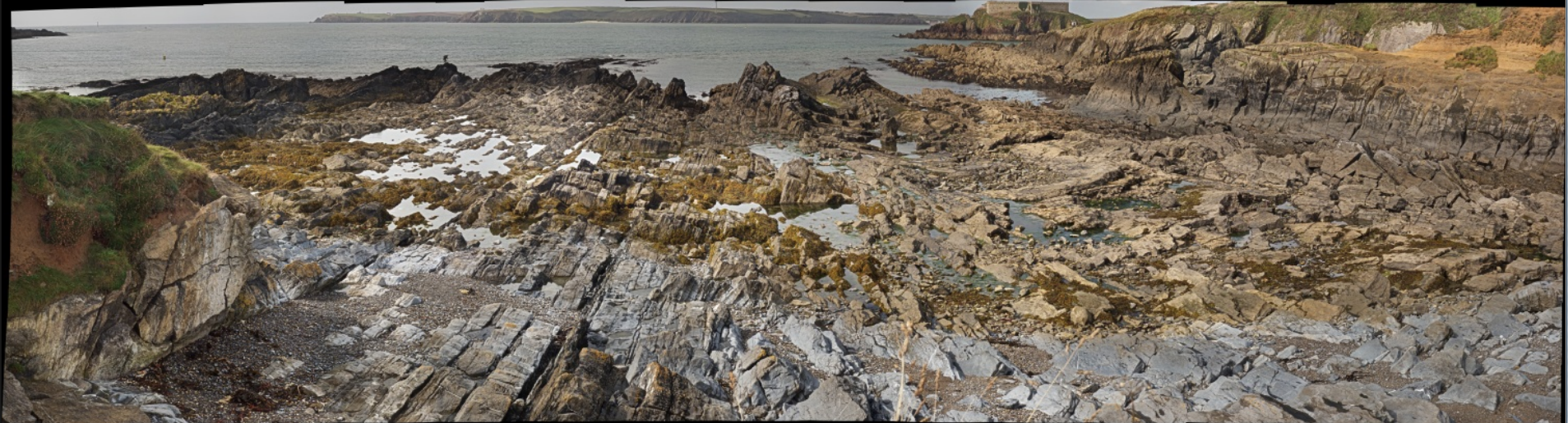

Ian wrote:......It shows the foreshore at West Angle Bay, Pembrokeshire, Wales. The view looks westwards towards Milford Haven and shows the Lower Carboniferous Limestone contorted by a series of Variscan thrust related folds. One of the thrust planes is seen in the left of the image, over-steepened by the folding. To the centre of the image are a pair of whaleback periclinal anticlines. The beds then steepen again to vertical on the right via a tight syncline.
But the beauty of a gigapan image is that one can dive in and view the detail like the slickenside lineations on the thrust plane or the writing on the buoy.


@-@-@-@-@-@-@-@-@-@-@-@-@-@-@-@-@-@-@-@-@-@-@-@-@-@-@-@-@-@-@-@-@-@-@-@-@-@-@-@-@-@-@

Garry float at Geotripper  is still spectacular even though it is at a place that's been photographed many a time.  (I'm having trouble with his link so here it is  http://geotripper.blogspot.com/2011/03/my-favorite-geologic-picture-oh-so-many.html  )


Long before I had a digital camera, I used a particular slide from a trip in the 1980s to introduce my students to the idea of the fascination of geology. It was taken next to one of the most famous photography spots in our national park system, but it is not a picture of the iconic feature. It's the trail leading to it. Delicate Arch of the "Real" Jurassic Park lies just around the corner, and a crowd is often found there, especially at sunset. But I see fewer people stop and consider this scene....


I got into geology in part because of the wonderful journey of imagination that it is; a geologist is a world traveler, and a time traveler. The trail in this picture is formed on a natural break in the rock. Why is the break there?


In Jurassic time 180 and 140 million years ago, tidal flats and coastal sand dunes spread across this part of Utah. The surfaces of the dunes were pathways for all kinds of creatures, from insects to giant lumbering dinosaurs. The walked and crawled on these sands, and later the surfaces were preserved by subsequent layers of windblown sand. The surface later hardened a bit more than the others, and millions of years later, erosion exposed the old sands. A fracture developed along the surface, and the trail-builders of a few decades ago found it a great deal easier to just remove the overlying rock than to carve a new flat surface at great expense. And so it is that during our brief sojourn on the planet, we walk on the same surface, and perceive the significance of that fact. We use our minds to explore strange alien worlds, and yet these are the worlds that existed before ours and which became the raw materials for our own.
Again, practically everyone walks up to Delicate Arch, but there is another arch just a few steps off the trail that provides a stunning view the distant La Sal Mountains, the laccolithic cores of 25 million year old volcanoes. This picture, taken just a few yards from the one above, contains the four elements of ancient human thought: water, earth, fire and sky (the water is in the sky and in the creek below). The essence of earth science...

@-@-@-@-@-@-@-@-@-@-@-@-@-@-@-@-@-@-@-@-@-@-@-@-@-@-@-@-@-@-@-@-@-@-@-@-@-@-@-@-@-@-@
 
Reynardo's float at  The Musings of the Midnight Fox   has a very interesting one with this to be said about it....

Charleston Cave

This one is from New Zealand. The Nile River Caves (as featured in WOGE #263) are on the north-west side of South Island, New Zealand, and as well as the expected beautiful limestone features, have some wonderful glow-worms and some rather interesting strata.

This one in particular is a mixture of mudstone and limestone. By the time this layer emerges at the coast at Punukaki, it's more clearly layered and makes the Pancake Rocks.

Yes, I have amazing glacier and volcano shots. But this one is the one that says "Geology" to me the loudest.


@-@-@-@-@-@-@-@-@-@-@-@-@-@-@-@-@-@-@-@-@-@-@-@-@-@-@-@-@-@-@-@-@-@-@-@-@-@-@-@-@-@-@


The float Elli has submitted at  Life in Plane Light  has this amusing tale to tell...


For my PhD research, I ended up working in the Swiss Alps.   Day one out was long, long, long (and it was magically also my birthday).   By the time we reached the col that was going to actually become my field area it was rather late in the day and we were still 1000 m above the closest road.   Bridget (my field assistant) and I were wearing every item of clothing that we had in our packs due to the cold (there was still snow on the ground & it was July).   Before we could call it a day, we decided to collect four samples (we had a number of other rocks from earlier at other sites to the south of the col).   Three popped out without an issue in reasonable sizes (enough for thin sections, tomography, and bulk chemistry), but the fourth was stubborn.   It came off in a huge sheet:

the large slab (behind the hammer) that eventually became 04AD15; Tom Foster in blue, Hannes Hunziker in the middle, and Lukas Baumgartner in pink
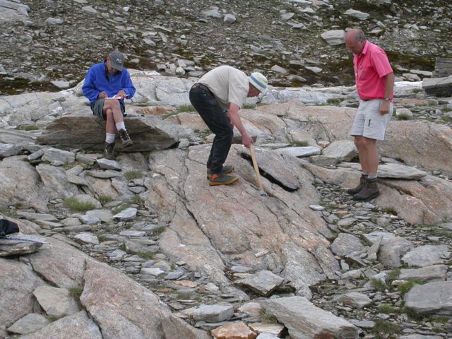
while Bridge and I proceeded to shiver, these three male geologists tried to get 04AD15 down to a reasonable size.   They used the sledge.   They used a hammer with a chisel.   They hopped up & down on the slab.   They wedged another rock underneath the slab and tried everything again.   Eventually, pieces started to fall of the edges.   In the end, 04AD15 is still my largest sample.   But its also my best sample of the bunch (including what I got a year later!), so all that work was worth it.   But whenever I look at anything related to the sample, I have to imagine three senior geologists trying like crazy to break the slab :)

04AD15 post-cutting


@-@-@-@-@-@-@-@-@-@-@-@-@-@-@-@-@-@-@-@-@-@-@-@-@-@-@-@-@-@-@-@-@-@-@-@-@-@-@-@-@-@-@


 Michael with Through the Sandglass   has apiece of art as his geologic float

Accretionary Wedge # 32

Sura2
The March edition of the Accretionary Wedge geoblog carnival is at Ann’s Musings, and the theme is a deceptively simple summons: “Throw me your ‘favorite geologic picture’ mister.”  This is nigh-on impossible and has led to some considerable introspection, not to mention scrabbling around to see what candidates I have with me on my laptop. But the scrabbling stopped as soon as I reminded myself of the image above. At first glance, perhaps it’s not strictly geological – but then again, yes it is. And, because of the very personal impact, it’s one of my favourite pictures – ever.  
It’s from a location in the remote south-western corner of Egypt, a Louvre of rock-art. This is just a small exhibit in a cave shelter covered in human expressions. The setting is geological, the canvas is geological, and the materials are geological, and all combine in the message of the connection between humans and geology. But of course it’s even more than that – we have no idea really who the artists were, exactly when they lived, what the function of this place was in their society, or why they expressed themselves so exuberantly. But the emotional  resonance, sitting there gazing at this, has become deeply ingrained; there is an immediate, intensely human, connection with two unknown people who chose to record their hands reaching out to each other.
It’s not even a picture of sand – but it is probably my favourite geological photo. And, in today’s world, perhaps it has an important message.

@-@-@-@-@-@-@-@-@-@-@-@-@-@-@-@-@-@-@-@-@-@-@-@-@-@-@-@-@-@-@-@-@-@-@-@-@-@-@-@-@-@-@

 Here's the  History of Geology    interesting float by David.
( I'm having trouble with this link so here it is http://historyofgeology.blogspot.com/2011/03/accretionary-wedge-32-favourite-image.html )
In a first moment I couldn't decide what image to take, the classic outcrop or the marvellous landscape? - but there is an elder picture of 2007 I really like, at a first glimpse it's geological context is not obvious, but this is also a reason that I like this particular picture.


The photo shows a species of club moss emerging from a pile of rubble. The club moss Huperzia selago is one of the two species of this genus present in the Alps; this species in particular can be found in high altitude and in glacier forelands, acting as pioneer species.
This specimen was emerging from gneiss and schist debris covering an active rock glacier; I like the contrast of the green plant to the cold grey of the rocks forming a sort of picture frame, the impression that the club moss overcomes every obstacle, even "breaks" the rocks apart to emerge from the underground.
For plants creeping debris and permafrost represent an ulterior challenge for colonization and growth in an already nasty environment, with long snow cover, low temperatures and deadly UV-radiation. I think the picture depicts well the struggle of existence in a harsh environment - but as the the rocks act as obstacle they at the same time also provide shelter
, moisture and nutrients.

For the geologist also the recognition of even the smallest clue can be helpful, I find it fascinating how many different methods can be adopted to understand the development of a geomorphologic feature or a landscape - in combination with classic geological methods for example the vegetation cover or diversity can give indications of the recent activity of rock glaciers, or help to reconstruct the temporal development when other indicators are absent.


And finally the image remembers me as a sort of metaphor what the German geoscientist Gerd Lüttig argued in 1971:


"Earth history can be described as a permanent interaction between the geosphere (lithos) and life processes (bios). To investigate these processes is the mission of Lithobiontics, a new research discipline between Geology and Biology."

@-@-@-@-@-@-@-@-@-@-@-@-@-@-@-@-@-@-@-@-@-@-@-@-@-@-@-@-@-@-@-@-@-@-@-@-@-@-@-@-@-@-@

Here's Philips float at   Geology Blues  is not only spectacular to look at but is special to for the memories it hold for him.  (I'm having trouble with this link so here it is
http://geologyblues.blogspot.com/2011/03/favorite-geology-picture-aw32.html  )
In a post about Multnomah Falls and Columnar Jointing, I posted this picture taken of Sam at Devil's Tower a few years ago. It remains one of my favorite pictures of geology (and Sam) as it provides such a great image to show several geologic principles at ones. Aside from the geologic signficance of the tower itself, the promionant geologic feature is the massive hexagonal piece that 7-year old Sam (for scale) is leaning against. Behind it, you can see the joints extending up the tower with clear hexagonal blocking roofs, allowing one to recognize the block as having weathered and fallen off the tower.


The picture also has trees and shrubs growing in the fractures below the main part of the tower. These fractures are not the columnar jointing of above, and so demonstrate a different condition of cooling for the base of the tower. The fractures below also have trees and shrubs growing amids the fractures illustrating yet another form of mechanical weathering.  

@-@-@-@-@-@-@-@-@-@-@-@-@-@-@-@-@-@-@-@-@-@-@-@-@-@-@-@-@-@-@-@-@-@-@-@-@-@-@-@-@-@-@

  The float at  Geology Happens  has this wonderful panorama view.
(I'm having trouble with this link.   http://geologyhappens.blogspot.com/2011/03/aw-32-favorite-images-anticline.html )

This was taken from the appropriately named "Anticline Overlook" of the Canyon Rims Recreation Area in eastern Utah. The anticline is obvious, you can see the upward curve of the rock units. I love the part where the river cuts through the anticline making a natural road cut.

The river cuts through the Permian age Cutler formation, the left overs from the formation of the Ancestral Rockies. The upward arching of these rocks is from the squishing (a very technical term) of a buried salt layer. Far below the Cutler lies the Pennsylvanian Paradox formation, a mile thick layer of salt that has a tendency to move about creating some fun landscapes in the desert southwest. The buildings and ponds you see in the picture are a potash mine. Water is pumped underground into the Paradox layer, dissolves the salts and the brine is pumped back to the surface into the blue evaporation ponds in the background. The water evaporates away leaving the salts for transport.

The fun part of this area are the roads. They are barely visible in the picture but they travel hundreds of miles through the red rock desert . A mountain biking heaven!


@-@-@-@-@-@-@-@-@-@-@-@-@-@-@-@-@-@-@-@-@-@-@-@-@-@-@-@-@-@-@-@-@-@-@-@-@-@-@-@-@-@-@


 Cain at  Point Source  has added this last entry to the parade of picture floats.
(I'm having trouble with this link so here it is  http://cbdawson.com/blog/2011/03/aw32-arachnoids-on-venus-2/  )
In the midst of reorganizing, I recently unearthed some deeply buried personal geologic records from past research projects.  One discovery was an image that previously adorned my wall:  a MagellanVenus. radar image of arachnoids on
Magellan radar image of arachnoids on Venus. (Image courtesy of NASA/JPL)
I think this image is a perfect fit for Accretionary Wedge #32 “favorite geologic picture.” It’s not the most colorful or dramatic image, but it holds an important place in my professional experience in the geosciences.
Arachnoids are geological features on Venus. They are characterized by a combination of radar-bright, concentric rings (like a bull’s eye) and radiating lineations (line-like features) and were named “arachnoids” because of their spider and web-like appearance.
Although these features had been identified on earlier Soviet Venera mission data, the NASA Magellan mission provided sufficiently high resolution radar imagery and elevation data to investigate them more closely.
These features were one of my first forays into geology research as an undergraduate student. What were they? Did all features catalogued as arachnoids based on the radar images have similar topographic features? What caused them? Where they all the same age? Where were they located? Was there a terrestrial geology analog? I had many questions, a patient research advisor, and a short summer.
The personal outcome was clear, though: I was hooked. Geology was fascinating, no matter where in the solar system. There were so many questions, and we didn’t have all the answers!  This was a far cry from the textbook science of packaged information and rote facts to memorize. The science was alive, the questions infinite, and the data plentiful.
Whenever I see these data images, they represent all of this in one snapshot: the excitement and mystery of geology.
He has more but you just have to go to his blog to read the rest of it.

@-@-@-@-@-@-@-@-@-@-@-@-@-@-@-@-@-@-@-@-@-@-@-@-@-@-@-@-@-@-@-@-@-@-@-@-@-@-@-@-@-@-@

And finally here's the Captains float -
The Red River at sunrise, seen from a balloon about 1000 feet up in the air.

The Red River

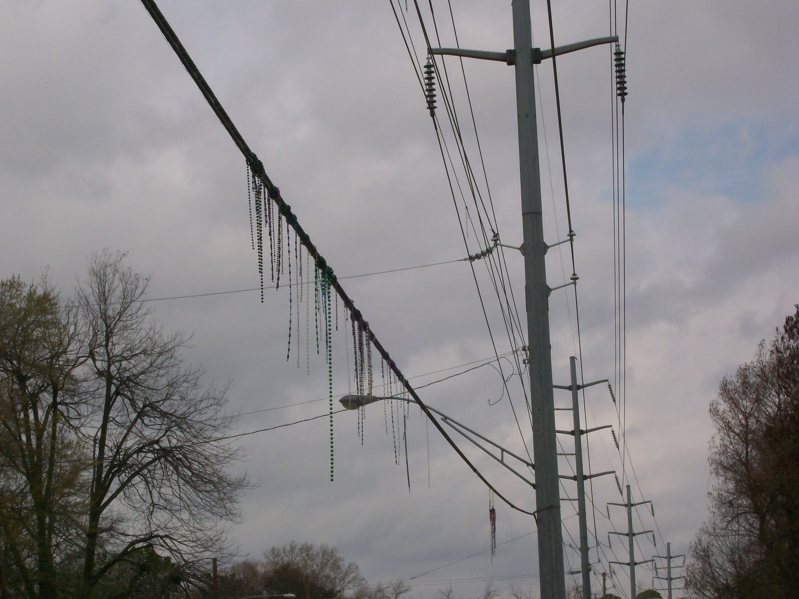
The beads are thrown and are now on the wire connecting to the internet web. I hope you had a good time.
Now all good things must come to an end.  The parade is over and it is time to go home.  Thank you one and all for submitting something for this Accretionary Wedge - 32.   
If you had something and didn't get it in  or if I missed it please leave a comment and I will add it later.


 Post script:
Here's a little bit about Mardi Gras for those who don't celebrate it like we do in Louisiana. 

 For those of you who don't know its officially Carnival time or Mardi Gras season  (Twelfth night to Fat Tuesday i.e. Jan 6 to March 8 this year).  Twelfth night is also know as the feast of the Epiphany and is celebrated by Christians as the day the three wise men came to visit the baby Jesus and is 12 days after Christmas.  Fat Tuesday is the day before Ash Wednesday.  Ash Wednesday is the first day of lent, a  time where you are suppose to make sacrifices and give up things, in preparation of Easter which is 40 days later. Because people may give up drinking, certain foods etc for the forty days during lent they like to have a big blow out where they consume the food that they will be giving up.  They usually do this the day before and thus the reason it is called Fat Tuesday or as the French call it Mardi Gras.

  To celebrate together different groups of people with like interests get together and form Krewes.  Most Krewes have a theme by which they go by. For example, in my area of LA there is a Krewe of doctors call Aesculapius and another one for Lawyers called Justinian and one of cat and dog lovers called Barcus and Meow.  I am a member of the Krewe:  Les Femmes Mystique.  If you haven't guessed it - its a group of women who are concerned about the community.  Although we enjoy our parties we also like to give something back to the community.  Every month we have a project to work on.  This keeps the Krewe together during the year when the parties are not going on.  Every month there is a different project, such as working at the food bank, help run the Susan G Coleman race for cancer, the march of dimes walk, gathering school supplies for children, getting and wrapping toys for the Toy's for Tots program, etc. It varies from year to year what all we do. 
  But the thing that most people know the Krewes by are by their parades.  My Krewe is not big enough to have a parade of their own so we augment other parades in the area by joining in on other floats in the parades.  When you are on a float, you provide all of your own throws - the things you toss to people.  People love to come and watch these parades because of the gaudy decorations and the stuff that gets tossed to them.  Beads are the most common thing, but there are also other things tossed to like stuff animals, wrapped candies/food, plastic cups and fake coins called doubloons (which can become a collectors item).  It's whatever you want to buy and spend, but you are restricted to things that can't hurt if tossed, also it can't be offensive to the public in general. 
  If you ever go to a Mardi Gras parade there are certain things you should know.  Namely they can't throw anything if the float is not moving, so don't try to stop a float to get something from it.  Also if it lands on the ground put your foot on it and then after the float has gone by then reach down and pick it up.  If you try to reach down and grab it expect someone to stomp on your hand.  Also when the float goes by everyone says 'Throw me something Mister'.  The reason they do that is because the people on the floats are usually in costumes, with their faces covered.  They cover their faces so they can remain anonymous. 

 Elaborate costumes are common with the Carnival.  Most Krewes have a King, and a Queen and a Captain the rest of the float leaders are called Dukes and Duchess. Because they are royalty they like to dress up to the part, thus the elaborate costumes.  These people hold their offices for one year, and then switch off at coronation Bals. There is also another bal that is thrown during the Carnival time where the other royalties come together to enjoy the hospitably of the different Krewes. The Captain of the Krewe organizes the bals and parade and is the person who is in contact with the other Krewes.  The King and Queen are the official representatives of the Krewe for that year and are expected to attend most events.  The King and Queen are very rarely married to each other.  The spouse or significant other of the Royalty person is officially named their consort.

Mardi Gras is all about having fun and celebrating life.  It is also about giving back to the community in which they live as a ways for friends and neighbors to get together so they can get to know each other better. For more about Mardi Gras here Wikipedia Mardi Gras.

Post Script:
I do want to thank everyone.  I did have some technical difficulties with this but eventually figured things out.  I do want to thank Callan for helpful suggestions, while I tried to get it done.  I must admit I agreed to be a host more for my own benefit than yours.  I've very inept with computers and doing things like this teaches me so much. I also do it so I can see all the amazing things that have developed in the geology field since I was last active in it. I enjoyed putting this blog together and it wouldn't have been possible if it wasn't for all the contributions I got.  Again THANK YOU.


Wednesday, March 2, 2011

My contribution to Accretionary Wedge #32

Here's my favorite geological picture.


The Red River

    The reason I like this picture so much is because it shows the Red River being a mature river, with its meandering back and forth across the page. I like the way the fog is rising from it, making the river/water stand out more. 
     I love pretty sunrises and sunsets and you can see it captured the very end of a sunrise, right before the pink color leaves the sky.
    I like seeing pretty blue sky's with clouds and this picture has both (I must admit I did enhance the blue on this picture since it was kinda washed out).


    The Red River flows from the northwest corner of Louisiana to a southeast direction until it merges into the Mississippi.  This picture is taken from about 1,000 feet up in the air, and was looking in the direction that the water is flowing, (to the southeast).  You can see the river in the bottom left hand corner, meander back and forth a couple of times until it fades out in the right hand center side. You get a sense of how large the river's floodplain actually is.
  Above the left hand side you can see an oxbow lake, that formed when the river straighten its course to make the water flow faster during a flood.  You can see the sediments accumulating on the one bank, and get the sense of erosion where it cuts into its bank.  There is a small island that has formed in center part, and you can see a chute.


The Red River as seen from 1000 ft up in a balloon

    In our area the Red River is a vital part to our economy.  On the Red we have the port which helps bring in products, via riverboat transportation. Because of the oxbow lakes and the river itself, we have plenty of fresh water in our area which makes it a desirable place for people to settle and for industries to be able to manufacture stuff.   It is also a source of entertainment with bass tournaments and recreational boating.  Finally the casino's were able to locate in our area because of the Red too.  

  Finally the other reason I like it so much is because I had always wanted to go on a balloon ride and this picture was taken while I did that, thus it is from a time when I have very happy memories. - It is a feel good picture to me. 

   I use this picture now for my screen saver picture on the computer.  Every time I open my computer I see this.  I often study it as I wait for things to open up.  It amazes me all the things I can detect in it, and keep on discovering new things in it.

Thursday, February 24, 2011

WHO WILL HOST THE NEXT ACCRETIONARY WEDGE

  I've only been involved with the Accretionary Wedge (https://theaccretionarywedge.wordpress.com/  ) for a short while, but I have enjoyed it so much. I want it to succeed. I keep on musing on who will be the next host after I do  AW -32: the Carnival  theme Throw me your ‘favorite geologic picture mister.
   To help me pick a topic I complied this list of the previous Accretionary Wedges.  I thought I would share this with others to maybe inspire someone with a new topic.

A  list of Accretionary Wedge topics that have been used so far:
AW -1. Why I Study Geology;
        2.  How the Earth Could Kill You;
        3.  Between Rock and a Squishy Face, Geology & Life;
        4.  My Pet Rock;
        5.  Geology Misconceptions and Pie;
        6.  Geohmms;
        7.  Geology/ist in the Movies;
        8.  Earth Day the Geologist's Way;
        9.  Significant Geologic Events;
        10.  Geology in Art;
        11.  Field Geology;
        12.  Geology as a Connector Science;
        13.  Geology in Spaaace!;
        14.  Favorite Places for Field Work;
        15.  Pondering the Geological Future of Earth;
        16.  Is One Life Enough?;
        17.  Time Warp;
        18.  Inspiration;
        19.  Out-of-the-Box Teaching Ideas;
        20.  Why? or Unanswered Questions;
        21.  Earth Science Out Reach;
        22.   Flash Wedge - how fast can Accretionary Wedge be accreted?;
        23.  What We're Up To;
        24.  Geologic Heroes;
        25.  An Illustrated Glossary of Cool Geology Things;
        26.  The Role of the Geosphere;
        27.  Important Geological Experiences;
        28.  DeskCrops;
        29.  "What Geological features about the area you call 'home' do you love?
                and what do you not  like?"
        30.  Bake Sale
        31. What geological concept or idea did you hear about that you had no notion of
                before  (and likely surprised you in some way).
        32. The Carnival  theme Throw me your ‘favorite geologic picture’ mister.

Also I want to take this time to thank all of the previous hosts for doing such a wonderful job.

     Now to add to the list.
         33.  Feng Shui Geology
         34.  Weird Geology
         35.  Favorite Geologic Word
         36.  What do I regret the most not getting...
         37.  Sexy Geology
         38.  Back to school


Now this section is copied from the orginal web site

Who’s hosting the next Accretionary Wedge?

The Accretionary Wedge is a geoscience blog carnival hosted by a different blogger each month. This page will be updated as necessary.
month:            Host       –       Topic
#5 – Jan 08:      Green Gabbro –   geologic mythconceptions (and pie)
#6 – Feb 08:      Lab Lemming –   things that make you go ‘hmm’
#7 – Mar 08:      Tuff Cookiegeology/ists in the movies
#8 – Apr 08:      Andrew –   Earth Day
#9 – May 08:      Julian –   significant geological event
#10 – June 08:    John Van Hoesenaesthetic geology (art, poetry, literature, etc.)
#11 – July 08 :    Ron Schott –   field geology (never happened, but might in future!)
#12 – Aug 08:   Callan Bentleygeology as ‘connector science’
#13 – Sept 08:   Chris (goodSchist)Geology in spaaaace!
#14 – Nov 08:   Geology NewsFavorite places to do field work
#15 – Jan 09:    Clastic DetritusPondering the geological future of the Earth
#16 – Feb 09:   GeotripperIs One Life Enough? (geologist’s lists of places to see)
#17- Jun 09:    Outside the InterzoneLet’s Do a Time Warp!
#18- Jul 09: Volcanista- Inspiration.
#19-Aug 09: Jim Lehane- Out of the box or “unusual” geological teaching tools, methods, or ideas. (Deadline August 21)
#20- Sept 09: Dave Bressan- What remains to be discovered and understood in the geological sciences? See full announcement here; deadline September 20.
#21-Oct 09: Tuff Cookie- Geologic Outreach; taking geology to students and non-geologists. (Dates and details of topic TBA, and subject to further elaboration by Jess.)
#32- March 11: Ann’s Musings- Parade of Geological Images
#33- April 11: Callan- Incorporating geology into the built environment.
#34- May 11: Dana Hunter- Weird Geology
#35-June 11: GeoEvelyn- Etymological Geology: favorite geological words. Deadline for posts moved up to Wed. 6/29.
#36- July 11: Geosciblog-science- What past mineral/fossil locality have you regretted not collecting more specimens from?
#37- August 11: Outside the Interzone- Sexy Geology- Here’s an older example, and here’s a more recent one.
#38- Sept. 11: Anne at Highly Allochthonous-  Back to School
#39 – October 2011: Evelyn at GeorneysDress Barbie like a Geologist for Halloween
#40 – November 2011: Michael at Uncovered EarthGeo-Lanterns
#41 – December 2011: Ron at Ron Schott’s Geology Home Companion BlogMost Memorable/Significant Geologic Event That You’ve Directly Experienced
#42 – January 2012: Ian at VolcanoclastCountertop Geology
#43 – February 2012: Hollis at In the Company of Plants and RocksMy Favorite Geological Illustration
#44 – March 2012: Simon at MetageologistMost important teacher
#45 – April 2012: Denise at life as a geologistGeological Pilgrimage
#46 – May 2012: Cat at Knowledge FlocsGeology, Life, and Civilization
#47 – June 2012: Jennifer at Fuzzy ScienceField Notes
#48 – July 2012: Charles at Earth-like PlanetGeoscience & Technology
#49 – August 2012: Dana at En Tequila Es VerdadOut of this World
#50 – September 2012: Evelyn at GeorneysField Camp/Trip Moments
#51 – October 2012: Matt at GeoSphereGeo Poetry
#52 – November 2012: Shawn at Vi-Carius – Dream Geology Courses
#53- December 2012: Lockwood at Outside the Interzone- The End of the World as We (Don’t) Know It.
#54 – January 2013: @glacial_till, @seismogenic and @UncoveredEarth at Geoblog to be Named Later – On the Rocks: Geo-Brews & Geo-Cocktails
#55 – February 2013: Maitri at Maitri’s VatulBlogGeo-Injuries
March 2013 – No Accretionary Wedge
#56 – April 2013: Andrew Alden at About: Geology – Geo Photography
May 2013 – No Accretionary Wedge
#57 – June 2013: Evelyn at Georneys“Seeing Geology Everywhere”
#58 – July 2013 – Evelyn at GeorneysGeoSigns!
#59 – August 2013: Mika at GeoMikaGeologic Field Guide Recommendations
#60 – September 2013: Matt at GeoSphere – Momentous Discoveries in Geology Throughout History
#61 – October 2013: Mika McKinnon at GeoMikaWhat do you do?
#62 – November 2013: Martin Bently (tentatively) at “being the collected thoughts of our hero” – Geollowe’en
#63 – December 2013: Hollis, at In the Company of Plants & Rocks, on Plants and Rocks, or Rocks and Plants.
#64 – January 2014: Geoblogger to be named, at Blog to be named, on topic to be chosen.

It seems to be updated on a regular bases but is not complete.

Monday, February 14, 2011

Accretionary Wedge #31- geologic idea you hear about that you had no notion of before

Jim's topic for the wedge is:
What geological concept or idea did you hear about that you had no notion of before (and likely surprised you in some way).

   This was a hard one for me, because I feel like there is so many things that could be written about and it's hard to narrow it down to just one. Finally I came up with this one.


THE ALVAREZ HYPOTHESIS  Here (Wikipedia)

   When I was in undergraduate school, the department I was in was very small.  Because it was so small the professors there encouraged us to go to conferences, intercollegiate field trips and listen to guest speakers at other nearby universities - where the department had some arrangements where we could get in, since they couldn't bring the speaker to our department due to budget constraints.
  When I was very new in the department some of the more senior students had gone to a conference in Toronto, Canada.  They came back and the few of us who didn't go were very curious about the conference - and were asking a ton of questions about it.  One of my friends was telling us all about it and that J.Tuzo Wilson was the speaker that got most of the attention with his theories about plate tectonics.  I couldn't believe it when one of my very old professors (he got his degrees before WWII) in the department said that J.Tuzo Wilson's (here)  stuff was a 'bunch of bunk', and his theories would not hold up with the test of time. (At that time '74, Wilson's theories were mostly known through his articles and he was mentioned in very few text books.)  I was absolutely shocked by this attitude of that one professor, because what little I had read of Wilson's theories seemed very believable to me. I felt like this professor was the one who was wrong.  I lost a lot of respect for him with that one comment, and started to question what he was teaching me in his classes. This professor had stagnated in his mind set by only accepting what he was first taught and not expanding his mind to other ideas that have developed with advent of other technologies.

   After that discussion, I told myself I should always keep an open mind and not limit my thinking like that professor had done with Wilson's theories.

    So a few years later, I went to visit another university to hear this guy present his research.  (I wish I could recall his name but it has totally faded from my memory and also the title of his speech.)  At first he was pretty charismatic and came across as being very believable.  He had done a lot of research on the Cretaceous -Tertiary (K-T)(Mesozoic/ Cenozoic) boundary. He theorized that some catalytic event had occurred, which caused the dinosaurs and other animals to have a mass extinction. The mass extinctions had been well documented for quite awhile, but what set his ideas apart was he was claiming that the extinction was due to a single event and not a gradual demise of the animals as it was then believed to have happened.  He pointed out how all across the world there was this dust layer with a radiation marker in it that could be traced which always was associated with the end of the period.  He had traveled to (or gotten) different places in the world collecting samples and then analyzing that layer.  He concluded that it had all come about from a single event, that caused the greenhouse effect  which lead to the mass extinction.
    Up to this point everything seemed very believable and done scientifically and thus deserved our consideration. This was something that was totally new to me and surprised me.  I was excited about the implications of what he was saying.
    But then he lost the audience as he told us his hypothesis as to what the event was that cause this dust layer.  What he then said caused so much commotion in the auditorium, I had never seen anything like that before or after. All these educated people then put him through one of the most grueling times I had ever seen anyone endure to defend his hypothesis.
  His hypothesis was that the dinosaurs had a nuclear war, and that was why there was this radiation associated with this layer.  He then went on and named Tyrannosaurus Rex as the perpetrators of this event.  He compared the brain size of a human and the T Rexes and pointed out how much bigger T Rexes were than humans and thus they must have had more mental capacity than man. He had some other data to back up his ideas but this is what stuck with me all these years.
   The man defended himself well but when he was done most of the people there dismissed everything he had to say as the old professor put it as 'bunk', because his hypothesis was so hard to accept.  Some of the comments I heard as I was leaving was he had been watching too much Star Trek or read too many science fiction books or had too much of an active imagination, etc.  What got to me was how they treated everything he had to say as wrong and didn't give him the benefit of the doubt for any of it being true.  I must admit I went along with the crowd, and thought it all crazy stuff too, but I also reminded myself I should keep an open mind. I didn't even consider that there might be another more reasonable explanation to muse upon.
   I kept on thinking about this speaker and how he defended him self.  One of his very last comments was 'If man were to have a nuclear war today, how would the intelligent life 65 million years from now know that man was just as intelligent and that he was able to develop devices that could destroy the world. Wouldn't everything he had created be destroyed either by the war or by the natural processes that were sure to have occurred since then. What evidence would there be to prove man was intelligent and that he was capable of causing so much destruction?'  I never heard of the guy again or of his theory and basically let it drop for my mind.

    Then around 1982, I saw an article about the Alvarez hypothesis. The Alvarez's were basically presenting the same type of results from their data that the first guy had obtained years before.  They too concluded that the K-T boundary was due to a single event only their hypothesis as to why this dust layer occurred was totally different.  The Alvarez's believed it was due to a meteorite hitting the earth.
   In my mind I compared the two. I could accept the Alvarez's hypothesis, while I couldn't the other guy. I felt sorry for the first guy.  The first guy had had very legitimate data yet he failed to connect the points properly. No one took him seriously and all of his stuff was dismissed as wrong. As far as I can tell his material was never published. Instead of getting recognized for the work he did do-- he is now forgotten.  While the Alvarez's presented something that the geologic community could accept, and they are now recognized for it thus getting all the credit for it.
  The point this guy failed to realize was the iridium discovered in association with this dust is associated with asteroids. A point that would have been easily missed since that connection wasn't widely established at that time.  I guess it surprised me that the 1st guy didn't consider the possibility of a meteorite impact and present that too. In fact it surprised me that none of us even brought that up as a possible explanation to ask him if he had considered that when we were grilling him.
(It did make me realize that I shouldn't fall in love with just one idea and that I should pursue as many different ideas as possible when analyzing things.)

    When I read the article by the Alvarez's, I was working as a geologist with a major oil company in the Gulf coast region.  At the time I was amazed that there were successful wells being drilled in areas that most of the industry had dismissed as being unproductive.  I felt these operators had some bit of information or technology that gave them some insight that the rest of us was missing.  I felt like I needed to come up with something along those lines too so that I could have an advantage over others.
    I felt this article might just might be it for me. It was something I could sink my teeth into and work with.  I wondered just how many people would make the connection to a single meteorite event causing the the Cretaceous Tertiary boundary. To most of them the K-T boundary was just a geologic time thing where there was mass extinctions with no connection to the gulf coast except in the naming and dating of the formations.
  I realized that iridium layer could be something that could be mapped and followed around the gulf area. Any place that had this sediment should then be able to be mapped. I figured it could have a characteristic mark on the well logs and maybe even with the seismic data. I gathered from what the Alvarez's wrote, that meteorite would have shaken up the whole world.  In the gulf area, there were already a lot of normal faults associated with the forming of the basin (going back to J. Tuzo Wilson ideas, which were then widely accepted  and used to interpret the formation of the gulf.).  The impact  of the meteorite and the resultant shaking of the world could have caused some of those normal faults to shift again.  The shaking could also cause the oil and gas to migrate. Traps may have been formed where there hadn't been traps before. The possibilities seem so exciting with what I could do with this line of thought.
  I tried to present my idea to my boss so I could work on it more.  I was reminded that I was a developmental geologist and I should stick to that- the idea was dismissed as bunk. It wasn't even passed on to the explorations geologists in the company. When I was done  with that meeting  I knew what that first guy must have felt like at the time. I felt like I was onto something then and was frustrated because I couldn't convince others of its merit. I let the idea drop and never followed up with it because there was so many other things to work on at the time. We were mainly trying to figure out why a zone was as prolific as it was when the electric logs indicated it should not be productive or barely produce anything at all. Since we couldn't rely on the standard interpretations we needed also figure out the extent of the field, which also taught me a very valuable lesson that things don't always happen to be the way you think it should be.... and to always keep your mind open to new ideas.

  Since then I've like seeing the work that has been done with the Alvarez hypothesis.  When years later they discovered the Chicxulub crater in the Yucatan peninsula and I heard about it, I felt my thoughts about this hypothesis would be even more relevant to the oil and gas industry than I had previously thought. Unfortunately by then I was out of the industry and into a totally different line of work so I've never had the chance to pass it on to anyone until now. I just wonder who else has thought like me along those lines?

HERE'S SOMETHING TO MUSE UPON -Even though I prefer Alvarez hypothesis and accept it, I keep on thinking back to the the first guy and sometimes wonder what if the first guy is right and the Alvarez hypothesis is wrong.  Just a thought.


Below is what Wikipedia has to say about that theory and impact meteor with regards to the K-T boundary.


Impact Event
The K–T boundary exposure in Trinidad Lake State Park, in the Raton Basin of Colorado, shows an abrupt change from dark- to light-colored rock.
White line added to mark the transition.

Radar topography reveals the 180 km (112 mi) wide ring of the Chicxulub Crater.
In 1980, a team of researchers consisting of Nobel prize-winning physicist Luis Alvarez, his son geologist Walter Alvarez, and chemists Frank Asaro and Helen Michel discovered that sedimentary layers found all over the world at the Cretaceous–Tertiary boundary contain a concentration of iridium many times greater than normal (30 times and 130 times background in the two sections originally studied). Iridium is extremely rare in the earth's crust because it is a siderophile, and therefore most of it travelled with the iron as it sank into the earth's core during planetary differentiation. As iridium remains abundant in most asteroids and comets, the Alvarez team suggested that an asteroid struck the earth at the time of the K–T boundary.[72] There were other earlier speculations on the possibility of an impact event, but this was the first evidence uncovered.[73]
Such an impact would have inhibited photosynthesis by generating a dust cloud, which would block sunlight for a year or less, and by injecting sulfuric acid aerosols into the stratosphere, which would reduce sunlight reaching the Earth's surface by 10–20%. It would take at least ten years for those aerosols to dissipate, which would account for the extinction of plants and phytoplankton, and of organisms dependent on them (including predatory animals as well as herbivores). Small creatures whose food chains were based on detritus would have a reasonable chance of survival.[58][69] The consequences of reentry of ejecta into Earth's atmosphere would include a brief (hours long) but intense pulse of infrared radiation, killing exposed organisms.[37] Global firestorms may have resulted from the heat pulse and the fall back to Earth of incendiary fragments from the blast. High O2 levels during the late Cretaceous would have supported intense combustion. The level of atmospheric O2 plummeted in the early Tertiary Period. If widespread fires occurred, they would have increased the CO2 content of the atmosphere and caused a temporary greenhouse effect once the dust cloud settled, and this would have exterminated the most vulnerable organisms that survived the period immediately after the impact.[74]
The impact may also have produced acid rain, depending on what type of rock the asteroid struck. However, recent research suggests this effect was relatively minor, lasting for approximately 12 years.[69] The acidity was neutralized by the environment, and the survival of animals vulnerable to acid rain effects (such as frogs) indicate this was not a major contributor to extinction. Impact theories can only explain very rapid extinctions, since the dust clouds and possible sulfuric aerosols would wash out of the atmosphere in a fairly short time—possibly under ten years.[75]
Subsequent research identified the Chicxulub Crater buried under Chicxulub on the coast of Yucatán, Mexico as the impact crater which matched the Alvarez hypothesis dating. Identified in 1990 based on the work of Glen Penfield done in 1978, this crater is oval, with an average diameter of about 180 kilometers (112 mi), about the size calculated by the Alvarez team.[76] The shape and location of the crater indicate further causes of devastation in addition to the dust cloud. The asteroid landed in the ocean and would have caused megatsunamis, for which evidence has been found in several locations in the Caribbean and eastern United States—marine sand in locations which were then inland, and vegetation debris and terrestrial rocks in marine sediments dated to the time of the impact. The asteroid landed in a bed of gypsum (calcium sulfate), which would have produced a vast sulfur dioxide aerosol. This would have further reduced the sunlight reaching the Earth's surface and then precipitated as acid rain, killing vegetation, plankton and organisms which build shells from calcium carbonate (coccolithophores and molluscs). In February 2008, a team of researchers used seismic images of the crater to determine that the impactor landed in deeper water than was previously assumed. They argued that this would have resulted in increased sulfate aerosols in the atmosphere, which could have made the impact deadlier by altering climate and by generating acid rain.[77]
Most paleontologists now agree that an asteroid did hit the Earth about 65 Ma ago, but there is an ongoing dispute whether the impact was the sole cause of the extinctions.[23][78] There is evidence that there was an interval of about 300 ka from the impact to the mass extinction.[79] In 1997, paleontologist Sankar Chatterjee drew attention to the proposed and much larger 600 km (373 mi) Shiva crater and the possibility of a multiple-impact scenario.

Tuesday, February 8, 2011

Call to post for Accretionary Wedge #32

(This was originally at "Ann's  Musings on Geology and other things" but that blog no longer exists and because of that I'm putting it here.)

It’s Carnival time or Mardi Gras time in Louisiana . This year the season is long – going from Jan 6 (Twelfth night) to March 8 (Fat Tuesday – day before Ash Wednesday). Since the Accretionary Wedge is suppose to be a carnival of blogs I think it is only fitting the wedge should have a parade of the blogs. I’m willing to be the captain of this parade.

The theme will be “Throw me your ‘favorite geologic picture’ mister” Lets have the floats (submissions) ready on March 4th so it can roll on March 8. Carnival time is all about having a good time and having some fun so lets get some colorful, fun pictures submitted. Laissez les bons temp rouler!! (Let the good times roll!)

 Please leave your posts in the comment section or email me at amowillis@yahoo.com.

DON'T FORGET:
Accretionary Wedge #31 - Call for Posts
So I was having a conversation with a fellow grad student who came into my office asking if I had ever heard of an euchario..something, eudiachario..something. I said I wasn't sure, I would need the real name. Then someone n the office chimed in with Ediacharian? She said yea, and everyone else is like "Oh, yea, we know that." And that leads me in to this month's Accretionary Wedge Topic:

What geological concept or idea did you hear about that you had no notion of before (and likely surprised you in some way).

I have a few ideas for my own topic, but I would be interested in what people have to say about this. Some things we think are obvious and just know about other people have never heard of.

The deadline for this is February 18th. Please post all your submissions in the comments section.
Located here  @ Jim Lehane's The Geology P.A.G.E!


THANK YOU CALLAN
I also want to thank Callan for having a wonderful Bake Sale at accretionary-wedge-30-the-bake-sale. Most things looked so good, I wished I could have been there in person to taste some of these treats.  It's a good thing I'm trying to control my weight and carbohydrate intake so reading about them was treat enough for me.

This post seems to be my most popular post because of that I'm creating the link to  AW-32 favorite geologic picture so you can see the pictures that were submitted.

Friday, January 21, 2011

Accretionary Wedge #30- bake sale

Callan Bentley put out the call as seen here - Bake Sale


I was too busy to have time to bake something,  I decided to go with something that I had in the house - so I'm using a King Cake.  For those of you who don't know its officially Mardi Gras season (Twelfth night to Fat Tuesday i.e. Jan 6 to March 8 this year).  During Mardi Gras one of the traditions is to have a King Cake. The King Cake is in celebration of the 3 kings that visited Christ.  It is traditionally oval in shape to commemorate our journey through life.  The top of it is decorated with three colors: yellow for power, purple for justice and green for faith.  The tradition is to hide a baby in the cake.  The person who gets the baby, ie the first person to touches the baby as they cut into it when they cut their piece, is suppose to have the next party with another king cake.  That person then becomes king or queen for the day.  (In our house that means getting out of doing chores).
    The King cake tradition is a time for family and friends to get together and celebrate life. We have been to so many places with king cakes it seems like someone in my family is always getting one and we need to fulfill our obligation of passing it on. Because of the football end of season playoffs it was the perfect excuse to have a king cake at our house since we had friends and family coming over to watch the games with us. In fact because the games occurred over a couple of weekend we ended up having more than one king cake at our house. Here's more on King Cakes with Wikipedia.


So here's the first cake that was eaten with the baby hidden inside.

Typical King Cake


So now you are wondering where the geology comes in.  At one point I thought of considering it as a concretion, or a volcanic crater but decided against those.
The whole fun of the King Cake is finding the baby inside of it.
To me it always reminded me of the fun I used to have looking for fossils out in the field.  You never knew where you would find one and if you did what shape it would be in.  It was more the fun of finding the treasure than it was having it to add to your collection.

So I decided to wait until the baby was found in a piece and then take that picture.  I thought it would just be a baby in bread. A simple fossil in a uniform sedimentary stone.  But with King cakes they are made with different ingredients inside the bread as well as having the the baby hidden inside.  Some of the different ingredients I have seen used are: cream cheese, pralines, strawberries or as with this one -- cinnamon.  I wasn't expecting to get the geologic display that I did with these cakes.  Here's the first one with the baby found. It reminded me of purple mountains, and my structural geology class where we studied anticlines and geosynclines.

King cake with a baby in it.


I thought I should classify it as an overturned anticline  Here's the scan of the picture that was used in my structural text book to explain overturned anticlines.  Structural Geology, 3rd ed. By Marland P. Billings (1972)pg 46. It also reminded me of the picture that was used in the introduction of the book so I also included that picture as well.

Plate 7B. Overturned anticline, Panter Gap, Rockbridge County, VA


                    Photo: N. H. Darton,  U.S. Geologic Survey.


Structural Geology 3rd ed, by Marland P. Billings.


It also reminded me of a formation I saw last year when I went to the Sundance film festival, in Utah.
This is a picture I took on the way to the Sundance resort where we stayed at while attending the festival. Here's the link to the  Sundance Resort.  I think I took this picture from Highway 15  looking east to the Mount Timpanogos - Wasatch, Utah  but I'm not positive about this since I was riding on a bus.  It looked like a faulted geosyncline but not being able to get out and really look at it I wasn't able to tell for sure.


One cake wasn't enough and we had another one and here's the baby in the second one.  Again I thought of the same things as I did with the first.


My description of the King Cake,
Alluvial sediments are sitting on top of a mound, underneath there is a thin layer of mud mixed with ice/snow holding it in place.  Near the surface there is a cave in the sedimentary layer.  The formation has been under extreme heat and pressure resulting in an overturn anticline.  Embedded in the layers, fossils of the Homo sapiens variety may some times be found.

Finally when ever I look at King cakes I think of the song from the movie The Lion King - Circle of life.