I want to thank everyone that submitted something for this post.
Call For Post - Accretionary Wedge # 29
The topic is: "What Geological features about the area you call 'home' do you love? and what do you not like?"
There is no one ideal place to live and study all the earth processes that fascinates me; I have had to pick one place - settle there and call it 'home'. Every place that I have ever lived and called 'home' for awhile has always had very interesting geologic features to it that makes it unique. In Northeast Ohio it was the effects of glaciation, in Southeastern Ohio it was the Paleozoic Cyclothems exposed in the Appalachian Plateau, and currently I live on a bayou in Louisiana. What is it about the area you that you now call 'home' that is so fascinating to you. What do you not like? Did you choose to live where you are because you love the geology of the region and just wanted to live the in the area or was there another reason that brought you there?
Each place that I read about made me want to be able to live there for awhile too so that I could explore and look at first hand what they posted. I know I can't afford homes in all these places so I'm just going to have to settle for taking vacations (hopefully a long one) in some of the areas. I am going to start with the United States since that is where most of the post are coming from.
THE UNITED STATES
When I first thought of this topic I thought that I would list them by states, but then as I read the posts I realized that they should be listed by regions since so many of the areas discussed cover more than one state. So I went and found one of my old Geomorphology texts called 'Field Guide to Landforms In The United States' by John A. Shimer (1972), his Geologic Provinces are:

2. Cascades
3. Sierra Nevada
4. Columbia Plateau
5. Basin and Range
6. Colorado Plateau
7. Rocky Mountains
8. Great Plains
9. Central Lowlands
10. Interior Highlands
11. Interior Low Plateaus
12. Appalachian Plateau
13. Ridge and Valley
14. Blue Ridge
15. Piedmont
16. Adirondacks
17. New England
18. Coastal Plain
19. Superior Upland
I must admit that I am new to hosting and am not very good with computers. I want to make sure that I have it so you can access these submissions and have put in some redundancy to ensure you can get there.Please bear with me.
I just had a few submissions but based on what I had:
1. Pacific Border
Jim @ Active Margin - writes about South Orange County (http://jrepka.blogspot.com/2010/11/geo-tours-in-south-orange-county-san.html) Geo Tours in South Oragne County: San Onofre State Beach . Here's some of the exciting things Jim likes about where he lives.
California is a geologist's paradise. In southern Orange County, opportunities for class field trips less than a half-hour from campus are abundant. A short drive up Silverado Canyon covers a significant fraction of the Mesozoic. We have world-class fossil beds in Mission Viejo with Miocene and Pliocene marine mammals and abundant shark teeth. Granitic mountains, active faulting, beaches backed by multiple marine terraces, Tertiary marine sedimentary rocks criss-crossed with recent andesitic and dacitic dikes, and the beaches are nice too...
For my geotour I present a basic outline of one of my class field trips:
Here are a few of his pictures that I thought were so interesting


Look to the blog to see the other interesting photo's about the field trip. To me this sounds like a very fascinating field trip that anyone interested in geology would enjoy going on.
2 + 1 Cascades and the Pacific Border-
Dana @ En Tequila Es Verdad - writes about Washington state (http://entequilaesverdad.blogspot.com/2010/11/such-civil-war-is-in-my-love-and-hate.html) Such Civil War is in my Love and Hate
Dana starts out with:
Simple answers to simple questions: love the variety, hate all the damned biology in the way. Well, I only hate the biology when I'm trying to look at geology and when it's giving my asthma fits - apart from that, I actually love it quite a lot.
She then expands with more reasons as to why she loves the geology in the area.
Dana includes some awesome photos that make you want to go there to see for yourself. And here they are:
 |
| Mount Rainier Peeking Through Clouds and All the Damned Biology |
 |
| Dry Falls |
 |
| Tarn Near Sunset, Hurricane Hill, Olympic Mountains |
4.+ 7 The Columbia Plateau & Rocky mountains
Helena @ Liberty, Equality and Geology - writes about Western Washington State (http://helenaheliotrope.blogspot.com/2010/11/upsides-and-downsides-of-mountains.html
Upsides-and-downsides-of-mountains
Helena writes
My favorite geological features are the volcanoes. These result from the subduction of the Juan de Fuca plate beneath the North American plate:
Now, my least favorite geological features of Western Washington are also the Cascades, because they help cause the massive, constant amounts of rain.
Here are some of her Illustrations and photos:
![Map, Plate Tectonics and the Cascade Range, [18K,GIF]](https://lh3.googleusercontent.com/blogger_img_proxy/AEn0k_uEzymSbhYMoh53nZU-Rx_L7ETGtLvOBEp7bs_UqtmiB0RXz1nISQEEQLq4uYAdGrbvtNRWqDXhp21H1P755Xpfqms5T9b-ry_4tdQHXu92x8FshTh1oYgAMKToeQWWC_5vKTYCHHzlIRReukEqdE4KPA5xbfqMB8Sj5Q=s0-d)

Mt. Rainier

Mt. St. Helens

Mt. Adams

I've only been in this area a couple of times but she makes me want to come back and see it all again.
5 Basin and Range
Silver Fox @ Looking for Detachment - writes about Nevada and the Basin and Range.
http://highway8a.blogspot.com/2010/11/i-can-see-for-miles.html I Can See For Miles...
Silver Fox's title says it all 'I can see for Miles...., and miles and miles.'
She also adds 'I love the mountains. (Note the trees and above-tree-line alpine terrain, a sometimes underated or underexplored feature of the Basin and Range.) (You have to check out the photos). I love the valleys. (Note the hot springs in the foreground, a nice and warm geologic feature of the Basin and Range.) I love viewing the mountains from the valleys. (Note the prominent range-front fault, one of the many fascinating geologic features of the Basin and Range). She concludes with - If there's anything about the geology of Nevada and the Basin and Range that I don't like, it's that there is just too much of it for me to see it all!


I know what she means about this because I did my summer field camp work in this area. You can't help but to fall in love with the area once you start to study it. It had a little bit of everything there. I just wished I had more time there.
6. Colorado Plateau
The geologist @ Geology Happens writes about the San Juan Mountains of Colorado
http://geologyhappens.blogspot.com/2010/11/what-i-love-about-geology-of-home-aw-29.html What I love about the geology of home AW-29
Here's a little bit of what the the geologist has to say:
How can you not love the San Juan Mountains of Colorado? Just in a single glance we can see sediment deposited in ancient seaways and ancient deserts, intense mountain building with its accompanied faults and folds and the topped off with all sorts of volcanic evidence from lava flows and ash deposits to hydrothermal mineral deposits then the whole mix was well glaciated just a short time ago. My only compliant is that the area is so complex that my small mind has trouble wrapping around some of the views. I keep saying that the rocks tell a story, well this story is a bit complex.
Check these out.
A high country lake near Silverton Colorado
 Red
Mountain #2, taken from Red Mountain #1 on the edge of the Silverton
caldera. Obviously a heavily mineralized area with not-so-original
names.
Red
Mountain #2, taken from Red Mountain #1 on the edge of the Silverton
caldera. Obviously a heavily mineralized area with not-so-original
names. An arch found in the Cedar Mesa formation
 That's
me on top of Bow Knot bend, named by Powell as the Green River flows 7
miles to travel 600 yards through a very tight entrenched meander.
That's
me on top of Bow Knot bend, named by Powell as the Green River flows 7
miles to travel 600 yards through a very tight entrenched meander. Entering spilt mountain in Dinosaur NM on the Green River
9. The Central Lowlands have a couple of ones with
Matt @ Research at a snails pace talking about western Wisconsin
http://pascals-puppy.blogspot.com/2010/11/home-is.html Home is...
Matt's was short and sweet and to the point - he also includes some photo's for illustration.
I like the challenges of piecing together the little bits of information that tell me about the evolution of this landscape. I also like that there are many scenic little rivers that are near my house.

I do wish we had some big mountains nearby...

...but I guess that's why we go on field trips.
The other is David @ Love in the Time of Chasmosaurs writing about Northwest Indiana
http://chasmosaurs.blogspot.com/2010/03/love-in-time-of-crinoids.html Love in the time of Crinoids
David writes:
Now my wife and I live in Bloomington, in south central Indiana, and it's lousy with interesting geology. The bedrock under my house is limestone created during the period called the Mississippian. This was the first half of the period more widely known as the Carboniferous, named for the great coal-bearing strata it contains. The coal is the compressed biomass of the swampy forests that were the dominant land ecosystem of Carboniferous Earth, a process that mainly took place during the second half of the period, called the Pennsylvanian. The Mississippian deposits underlying Bloomington are the remains of shallow seafloors, and then as now, shallow seas teemed with life.
Thanks to this, I've collected a small assortment of marine fossils, mostly fragments of sea lilies called crinoids, as well as a few brachiopods. Really, you could do a lot worse than the Carboniferous when picking a place to live. It's arguably the geological period with the deepest impact on our lives, offering up the coal on which the industrial revolution was run and limestone that went into building the Pentagon and the Empire State Building, among others. Any Indiana kid feeling left out of the dinosaur fossil jamboree of the Western US actually has plenty to be proud of.
Check out the rest of what he has to say. He concludes with:
Here are a couple photos of a some crinoid stem pieces I found last year. Get enough of them and you've got one handsome necklace.


12 Appalachian Plateau
Jessica @ Magma Cum Laude writes about Western New York
http://blogs.agu.org/magmacumlaude/2010/11/12/gas-seeps-in-western-ny/ Gas Seeps in Western NY
Jessica writes: (I just had to include this photo since I thought it was so amazing.)
One of my favorites is in the Shale Creek Preserve at Chestnut Ridge Park. See why?
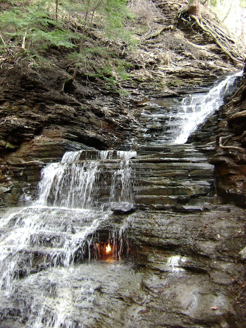
The Eternal Flame falls at the Shale Creek Preserve
I am going to definitely have to check this out!!!!
18 Coastal Plain
My submission is located in Northwest LA, under Accretionary Wedge 29 - Geologic features
http://annsmusingsongeologyotherthings.blogspot.com/2010/11/accretionary-wedge-29-geologic-features.ht
19. Superior Upland
Some how I miss Anne's post at Highly Allochthonous http://all-geo.org/highlyallochthonous/ The Driftless Area . Sorry Anne - I've now edited it so here's your area too.
The Driftless Area: Fewer glaciers but more topography than the rest of Minnesota
At the Last Glacial Maximum, the Des Moines lobe lay to the west of this area and the Green Bay lobe lay to the east. But in this area, the land surface was not covered with ice. For this reason, extreme southeastern Minnesota, northeastern Iowa and western Wisconsin together are known as the Driftless Area, because drift is an old name for till, and where there were no glaciers, no till could be deposited.
Even before the last glacial period, the Driftless Area seems to have uniquely escaped the terrain smoothing, till depositing influences of the ice sheets. (Play with this animation to watch southeastern Minnesota avoid glacial advance after glacial advance.) The map below shows the maximum extent of glaciers at (a) 1 million years ago, (b) ~600,000 years ago, (c) ~250,000 years ago (the Illinoian glaciation) and (d) ~22,000 years ago (Wisconsinan glaciation). In all of those reconstructions, there’s a stippled doughnut hole that defines the Driftless Area.
")
Glacial advances relative to the formation of the Driftless Area (Reinertsen, 1992*)

Topography of the Driftless Area and surrounding regions
")
Hillsides of the Driftless Area (image by McGheiver on Wikimedia)
–
*If anyone can help me track down the full citation of this article, I’d be most appreciative. I borrowed the image from here.
NOW FOR THE REST OF THE WORLD
David @ History of Geology just sent his submission from The eastern Alps
http://historyofgeology.blogspot.com/2010/12/accretionary-wedge-29-geologic-features.html
He writes:
Accretionary Wedge 29 - Geologic features of 'home' I do not like
Making a living as field geologists in the Eastern Alps has some advantages, there is a great variety of rocks to map and you can easily pass from the valley floors with cities and villages, passing by dark forests to the bleak peaks of the mountains.
But this dualisms of the landscape also hides a great injustice to the geologist. Humans tend to build and live in the lower storeys of the mountains, areas mostly covered by boring rubble and nasty plants, zones where the outcrop-quality and quantity is scarce and low.
The higher storeys of the mountains have excellent outcrops, but you rarely will find somebody who pays you to map these zones. So you have to suffer and map zones in the middle of the forest, and in the rare glades you can spot the distant mountains, like sirens calling, and like a fata morgana unapproachable.
The cruel truth
 Sometimes it is hard to be in the field, maybe better turn back...
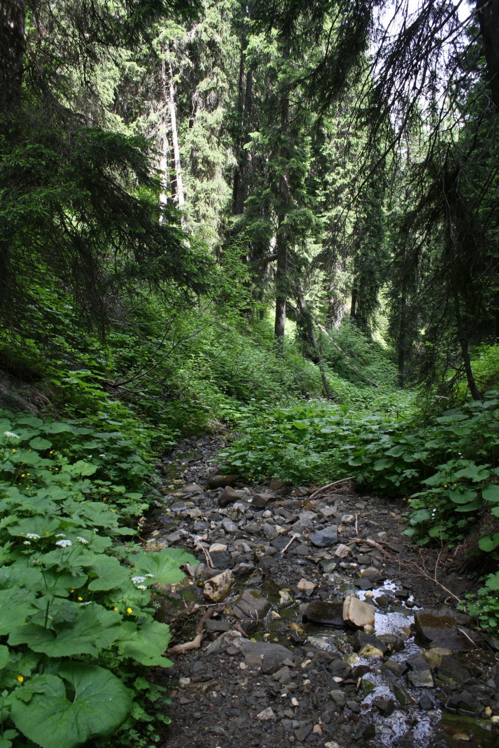 ...oh, well, never mind...
 Finally out of the forest...
 Outcrop No.1.
 Where is the next outcrop... I think I will map "Quaternary undifferentiated", what's planned for tomorrow ? ... map area "thorny shrubbery"…
NOW BACK TO ME AGAIN
This has been so much fun and such a learning experience for me. Again I want to thank everyone that sent me material. If you miss this call and want to submit things to it I am willing to add more to it. I do realize there was a problem with getting the call into the Wedge itself and realize some of you may not have known it was out there.
No comments:
Post a Comment